
Like so many of the lower Eastern Shore’s end-of-the-road communities, Taylor’s Island — bustling in the 18th century — is a picturesque, history-laced backwater.
Twenty minutes west of Cambridge, the drive to the island passes through part of Tubman country, a little adventure itself. Md. Route 16 brushes past Madison, a bayside village, which in Harriet Tubman’s time was named “Tobacco Stick.” A canal there was dug by enslaved people in the early 1800s and part of it is still in use as a local waterway. Just past Madison is a large area of woodlands where Harriet ”Rit” Green and Ben Ross—Ms. Tubman’s parents—built their cabin, according to recent archeological finds.
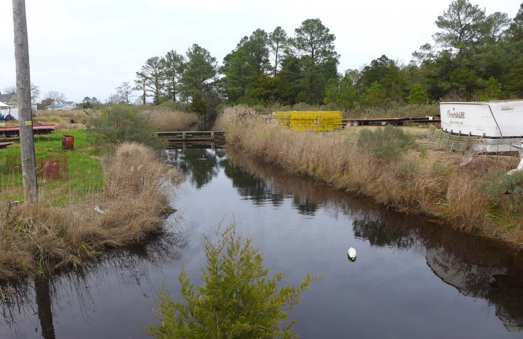
After crossing Stewart’s Canal, another slave-built canal extending south from Parsons Creek, you reach the bridge over Slaughter Creek to arrive on Taylor’s Island, thought to have been settled in 1662.
Just beyond the Slaughter Creek bridge is a gazebo with an ancient ship’s cannon, relic of the War of 1812. During a battle in January 1815, the “Becky Phipps Cannon” was seized by embattled locals from the crew of a British tender. A brochure supplied by the Grace Foundation of Taylor’s Island is available here. The non-profit foundation owns and has preserved several of the island’s historic buildings, which are described in the brochure and on plaques at each site.
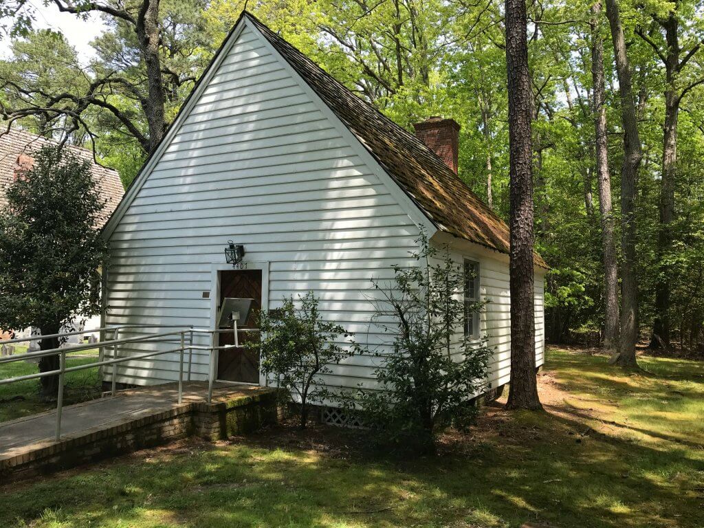
The oldest remaining structure on Taylor’s Island is its first church, an Episcopalian “Chapel of Ease.” Built between 1707 and 1720, it was moved to its present location on Hoopers Neck Road in 1952. After being abandoned as a church, it was used as a schoolhouse for Black children, a community center and polling place, and as storage for hay and grain.
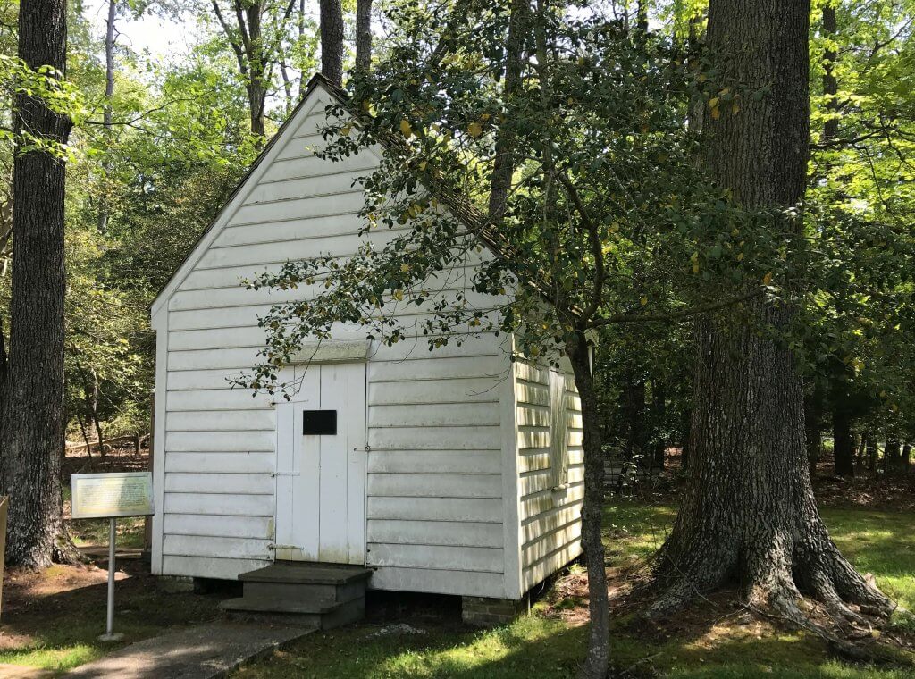
Next to this chapel is a schoolhouse, circa 1780. Only about 15 feet square, this tiny structure accommodated up to 12 pupils. First located at the north end of the island, it incorporates hand-hewn timbers, hand-made nails, and wooden pegs. “Originally,” reports the brochure, “it had a stove pipe hole in each wall so the pipe could be shifted to suit the prevailing wind.” After being abandoned as a school in 1855, it was purchased by a local farmer for his smoke house.
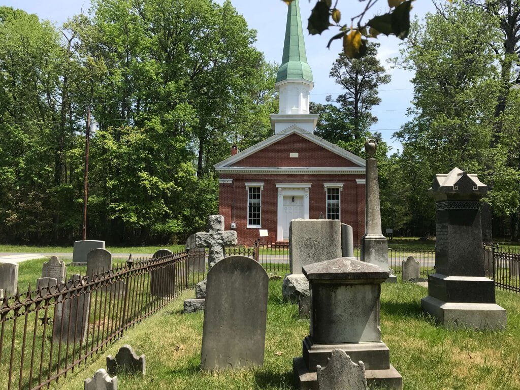
The third structure in this group is Grace Episcopal Church, built in 1873 and now used only on special occasions. All three buildings on this site are listed on the National Register of Historic Places and owned and managed by the Grace Foundation.
Farther north on Hoopers Neck Road are two more churches. The first was built in 1897 by an African American congregation. Reportedly the site of popular camp meetings, it’s no longer in use. The second is on the site of Dorchester County’s first Methodist church, a wooden chapel built in 1787. The brick structure dates from 1857. Directly across the road is a well-kept cemetery with stones dating from the 1700s and several family plots.
There are four other notable structures described in the Foundation’s brochure:
- Taylor’s Island General Store, built in 1916 to replace an older store destroyed by fire. The store morphed into “The Island Grill,” which has closed;
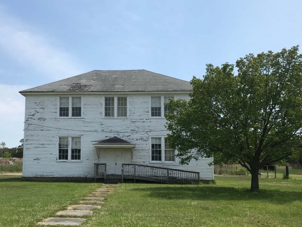
- Taylor’s Island school, built in 1917, was also used for community meetings, church suppers, and as the community center. Closed in 1974, it’s now a local museum;
- Chaplain Memorial Methodist Church, dating from 1889; and
- “Ridgeton Farm,” an Italianate-style home from 1859, is privately owned.
Elsewhere on Taylor’s Island is the Robinson Neck/Frank Ewing Preserve, with a self-guided nature trail. This preserve is on Robinson Road, about 2.7 miles south of the island’s village. It consists of a brackish tidal marsh and a loblolly forest, plus a small freshwater marsh. It is open for public use year-round. (Go to: http://www.gracefoundation.net/self-guiding-nature-trail.html)
Historical footnote: In colonial days, Taylor’s Island was a factor in the incessant state boundary battles between Lord Baltimore and the Penn family. In the 1700s, a protracted dispute arose over where to locate the “Middle Point” on the “Transpeninsular Line” that ran directly west from Delaware’s Fenwick Island, crossed over Taylor’s Island, and ended at Chesapeake Bay. Without going into minute details, had a court ruled that Taylor’s Island wasn’t an island and was instead part of mainland Dorchester County, the north-south boundary line between Maryland and Delaware (surveyed by Mason and Dixon) might now be two miles farther east!
Cover photo: Bethlehem Church Graveyard, circa 1787.
All photos by the author.